Collecting data to solve problems is our primary goal.
Our team collects visual images from above on “assets” such as a water tower, rooftop, solar panel or wind turbine. These images become the unit of measurement that is vital to make informed decisions as to maintenance schedules, repair or replacement timelines, as well as the general condition of an asset that is hard to reach or difficult to access from remote locations.
Facility Managers, Project Managers, or anyone responsible for maintaining a building or structure need accurate data regarding the current condition and other physical attributes.
Finding a maintenance solution before it becomes a major problem saves both time and money. You can depend on the Harmony Drones team to solve any challenge!!
Once the data is collected, we use in-house processing techniques, high definition cameras, video recording devices such as Aerial Lidar imaging equipment, Thermal Radiometric Imagers, High Resolution photo imagers, as well as mission specific GPS sensors to assess the situation and deliver a detailed report on the recommended solution.
Harmony Drones can effortlessly procure your valuable data with a brief description of the problem and data required, as well as an address for our Flight Crews.
With the use of our in-house, state of the art video and imagery Data Processing lab, Harmony Drones turns this raw asset data into usable and easy to understand imagery and reporting tools so that you can focus on the final objective, not the task of obtaining the information.
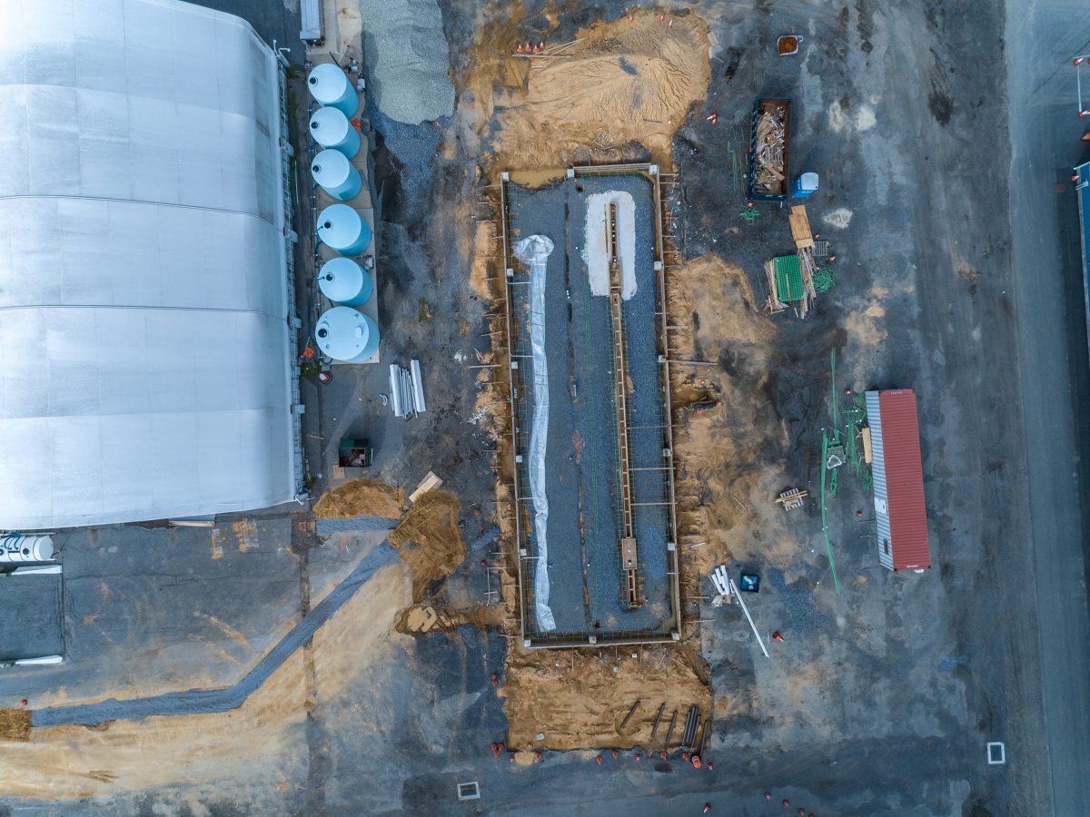
Here are some common situations for our Asset Data Collection services:
- Construction sites and infrastructure support services
- Progression imagery for new construction and renovation projects
- Evaluation of site conditions such as flood plains and traffic flow
- Thermal assessment of rooftops
- Thermal assessment of energy loss through windows & doors
- Thermal assessment of parking lots and underground channels
- Community and Municipality LED / Halogen lighting assessments
- Planning and development of commercial, private, and municipal land
- Existing conditions of structures and buildings
- Stockpile volumetric assessment missions
- Gravel, sand, salt pit inventories
- Construction debris and reclaimed asphalt pavement
- Bridge and tunnel inspection service missions
- New Construction or renovation of roads, byways, and highways
- Undeveloped private, commercial, and/or municipal land
- Solar panel fields
- Energy power plants and grids
- Utility pole and line assessments
- Marina and harbor conditions
- Municipality public safety checks – damaged rooftops, abandoned properties
- Request for proposal material – Site imagery and evaluation both aerial and terrestrial
- “Threatscape Assessment” facility and event threat assessment flights for the planning of safety and security initiatives


")